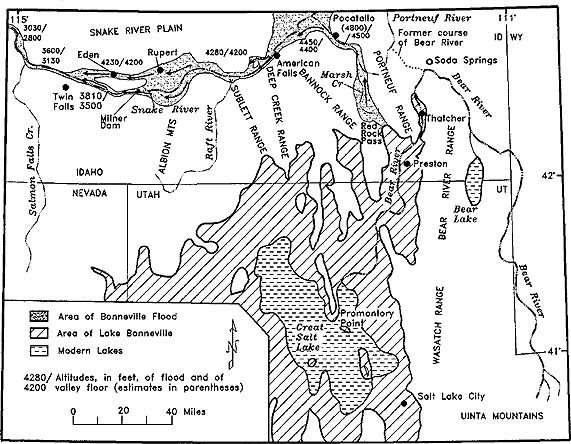
Labels:text | diagram | plan | map OCR: 15' Pocatello Portneuf River 3030/ (4800)/ 2800 SNAKE RIVER PLAIN WY 5600/ 4280/4200 4450/ /4500 \ Former course 10 Edan Rupert 4456 of Bear River PORTNEUF RANGE 3130 4230/4200 American o Soda Springs DEEP CREEK RANGE Fails CANNOCK RANGE Marsh Bear River SUBLETT RANGE Twin 38107 Folls 3500 Milner Snake River Dam Thatcher RANGE Preston Raft River IDAHO ALBION MIS NEVADA UTAH UT RIVER Bear Rivm Bear Lake Salmon Falls Cr. DEAR Bear River Area of Bonneville Flood Promontory Area of Lake Bonneville Great- "Point Modern Lokes Lake WASATCH RANGE 4280/ Altitudes, in fect, of flood and of 4200 valley floor (estimates in parentheses) Salt Lake City 0 20 40 Miles UINTA MOUNTAINS